112-113
Jungfraujoch to the Lotschenpass
A long chain of mountains running NE-SW which actually starts
with the Eiger and the Monch (which are described in another
section). The whole chain maintains a height of over 3000m, and is
consistently well above this in the NE half, over most of its length.
There are no easy crossing points on the whole of the ridge except
over the Petersgrat. The climber is thus presented with considerable
problems if wishing to return to the valley after doing routes on the
Lauterbrunnen wall- the magnificent N side of the chain extending
from the Rotalhorn to the Lauterbrunnen Breithorn. The rock
quality on the faces leaves much to be desired but on the ridges it is
generally quite good. Most of the routes from the S side of the chain
are quite easy whilst those from the N are much more demanding
and require a great deal of ability and commitment as well as fitness.
The major peak in the chain is, of course,
the
of the first 4000m peaks to be climbed and is regularly climbed
today thanks to the easy access provided by the Jungfraujoch
railway.
The chain is delineated on its S and E sides by the
Jungfraufirn, and by the Grosser Aletsch glacier on the E side of the
Lotschenhicke and by the L6tschental on the W side of this pass.
To the N is the Lauterbrunnental to the E of the Tschingelpass and
the Gasteretal to the W of this pass.
Map covering this section is:
J Rudolf and H Meyer with J Bortis and A Volker,
Winter: Miss Brevoort and W Coolidge with C and U Almer,
22-23 Jan 1874
The
From the N side it has a look of impregnability but from the S it is
much more amenable, although not easy to approach unless use is
made of the Jungfraujoch railway. Only the ordinary route is short;
all other climbs are quite lengthy undertakings and not that easy to
retreat from in the advent of bad weather.
150 SOUTH-EAST
RIDGE FROM THE ROTTALSATTEL
PD First ascent party
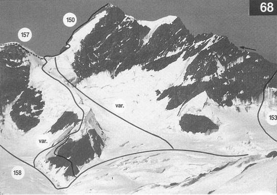
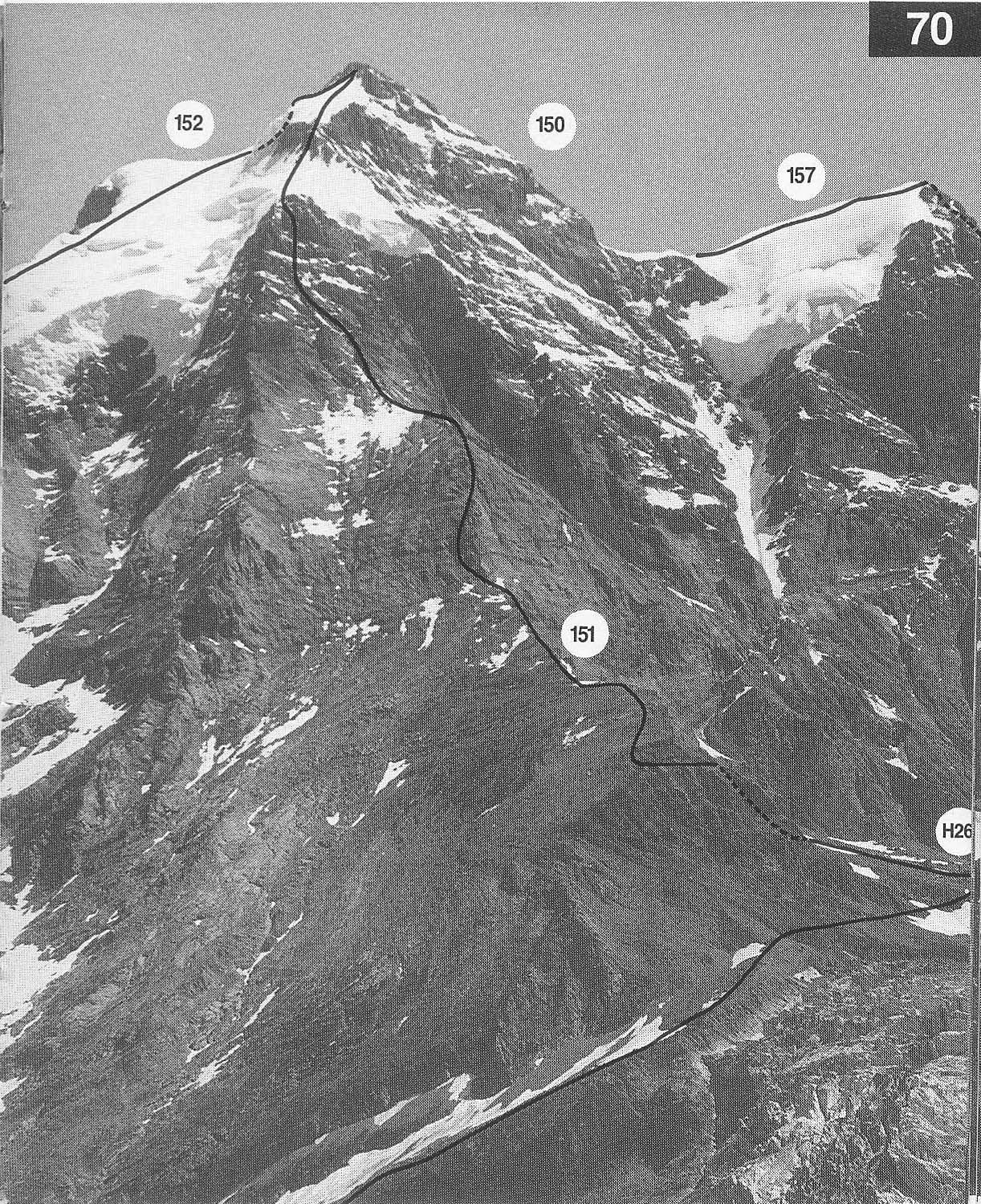
68 A much frequented route in summer and spring since there is easy access to
the fungfi-aufirn from the Jungfraujoch railway. Less wealthy alpinists
may prefer to approach from Konkordia. Several parties have come to
griefon this climb in the past at the traverse just above the Rottalsattel.
This has been made safe by the installation of fixed belay posts. See also
Photo 70
From the Monchjoch hut retrace the track to the Sphinx tunnel
entrance. Descend the Jungfraufirn Swards (crevasses) to the foot of
Pt 3411.1m. Scramble up the rocks (rain gauge) on traces of track to
where the angle steepens. Climb another 8m (abseil slings and ring
piton) then make a long traverse L onto easy angled snow. Now gain
the crest of the broad snow ridge above. Alternatively and more
commonly pass round the S side of this point to a steep snow slope
which is climbed to the broad snow ridge. Continue on the ridge
until it is possible to traverse R (usually a trench) to below the
Rottalsattel. Climb steeply up to the col (usually from the L in
summer).
Climb about 50mabove the col and traverse the snow/ice
slope (posts) to the rocks on the L. Climb the rocks and snow
patches to the summit. 3.5 -5hr.
It is sometimes possible (in a very snowy year) to reach the
Rottalsattel by ascending SW into the coombe directly below the
col. The bergschrund below the col is often impassable. This saves
about 1hr.
From Konkordia hut climb the L side of the Jungfraufirn to
Pt 3411.1m (2-3hr) and there join the route described above.
112-113